Receiver-side evidence
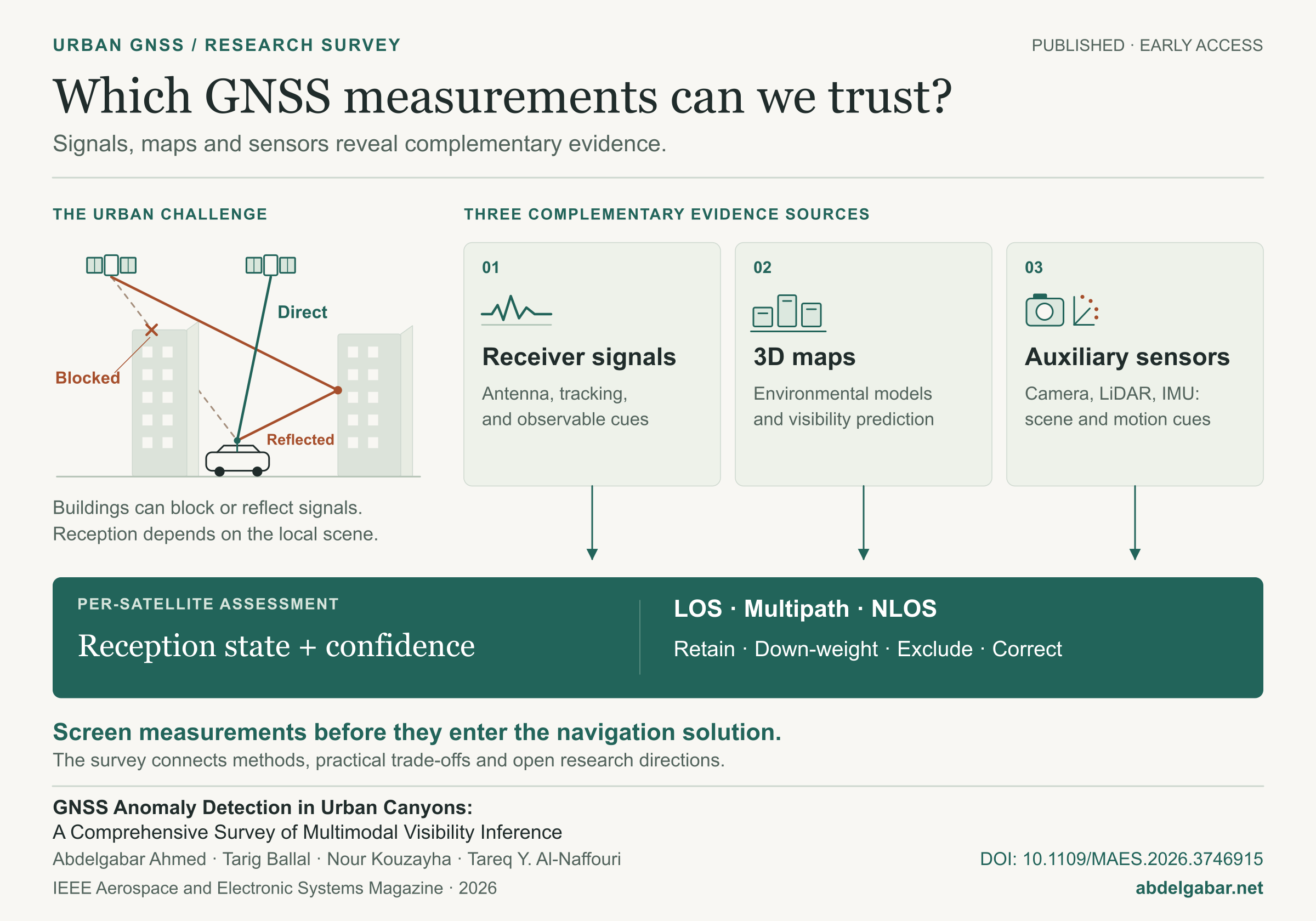
Antenna-domain information, tracking behavior, and GNSS observables reveal signatures of reception quality. Rule-based, statistical, and learning-based methods turn these cues into reception-state estimates.
Research survey · Visual summary
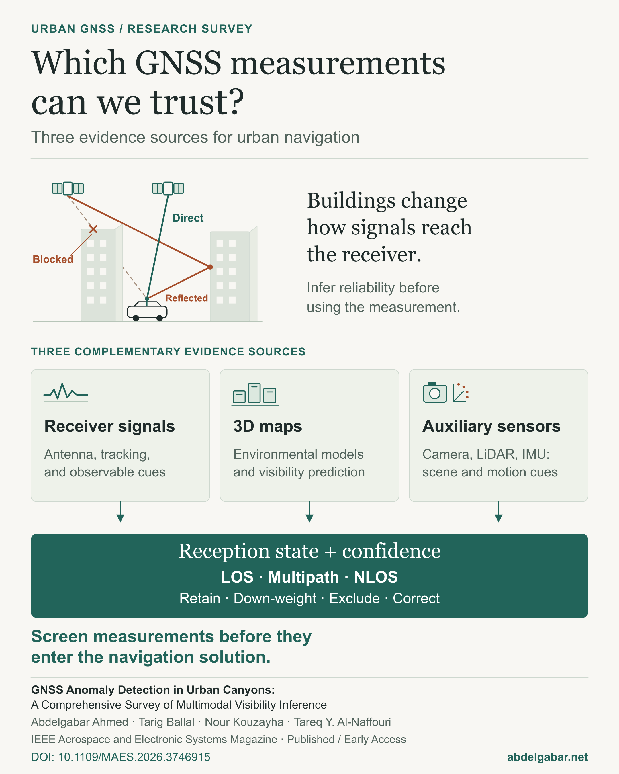
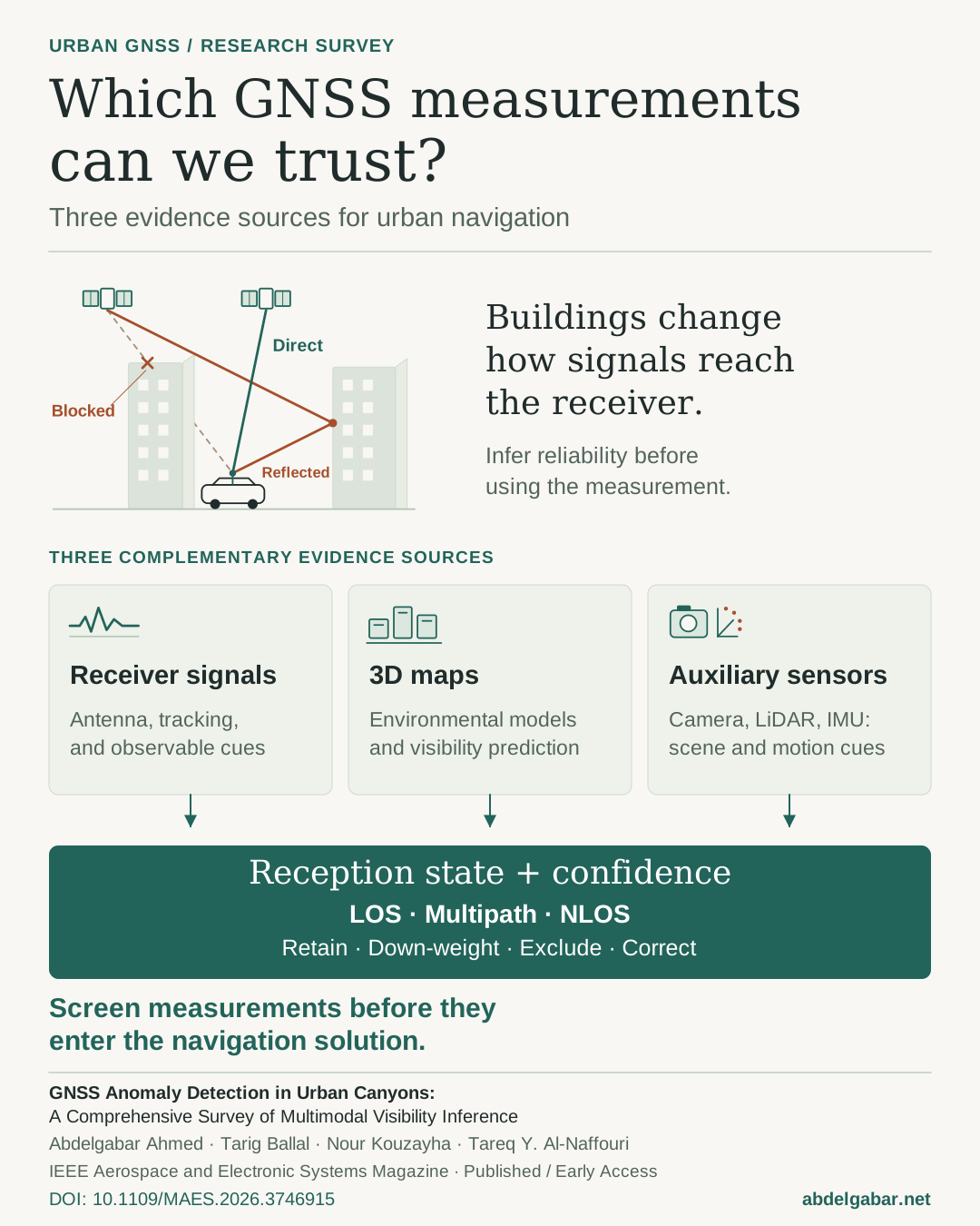
Buildings can block or reflect satellite signals. Our survey connects three complementary sources of evidence for assessing each measurement before it enters the navigation solution.
The idea
Antenna-domain information, tracking behavior, and GNSS observables reveal signatures of reception quality. Rule-based, statistical, and learning-based methods turn these cues into reception-state estimates.
3D environmental models support geometric visibility prediction and reasoning about blockage and reflected paths. Their usefulness depends on map detail, freshness, and alignment with the receiver.
Cameras reveal sky and occlusions, LiDAR provides local 3D geometry, and inertial sensors provide motion and attitude consistency. Together, these offer complementary checks on GNSS measurements.
Assess line-of-sight (LOS), multipath-contaminated, or non-line-of-sight (NLOS) reception and its confidence to inform whether a measurement is retained, down-weighted, excluded, or corrected. Complete blockage with no trackable signal is treated separately as unavailability.
The survey compares practical trade-offs and open challenges across these approaches. It emphasizes that the appropriate evidence depends on the receiver, environment, available sensors, and deployment constraints.
Journal survey Published · Early Access
IEEE Aerospace and Electronic Systems Magazine · Published online 26 October 2026
Original explanatory artwork based on the survey’s reception scenarios, evidence framework, and comparative synthesis (Figures 1 and 4; Sections VI–VII).